
After our continental breakfast in the hotel, my husband and I decided to discover another archaeological site called Scara Brae.
With our Tesla car completely charged, thanks to the app Pod found next to the Tesco supermarket in Kirkwall city centre, we started our new adventure.
Disappointed with the charging point of Tesla in Kirkwall
If you travel with a Tesla car, be careful with the only charging point in Kirkwall because the manager tries to push you to buy his products or pay to consume coffee. If you do not do it, he blocks the chargers with his employee’s cars or switches the electricity off. I hope Tesla can realise that the manager of this distillery in Kirkwall is not fair and decides to move the chargers to another location.
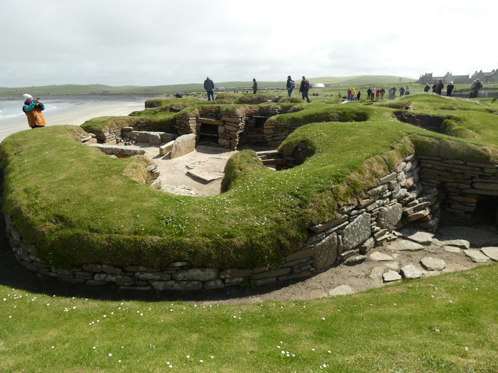
Scara Brae
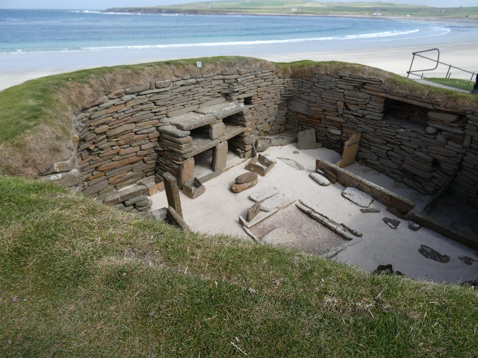
Skara Brae, first uncovered by a storm in 1850, remains a place of discovery today. Once you arrive, you first visit a replica Neolithic house to see how its full interior might have looked. Then follow the path that overlooks the ancient buildings, imagining what life was like for the farmers, hunters and fishermen who lived here. The prehistoric houses still contain stone ‘dressers’ and box beds.
Skara Brae is a World Heritage Site.
What to see and do
Walk around an extraordinary village the best-preserved group of prehistoric houses in all of Western Europe. Explore the nine surviving Neolithic houses, all but one of which can be viewed from the path. View original ‘fitted’ furniture made 5,000 years ago. See artefacts, including gaming dice, tools and jewellery, on display in the visitor centre
During the visit, do not forget to look at the stunning variety of local birdlife and wildflowers near the beach, and if you are lucky enough to have the sun, you can see the beautiful blue sea and the amazing white sand.
Not far from the visitor centre, there is another tourist attraction called Skaill House.
Skaill House
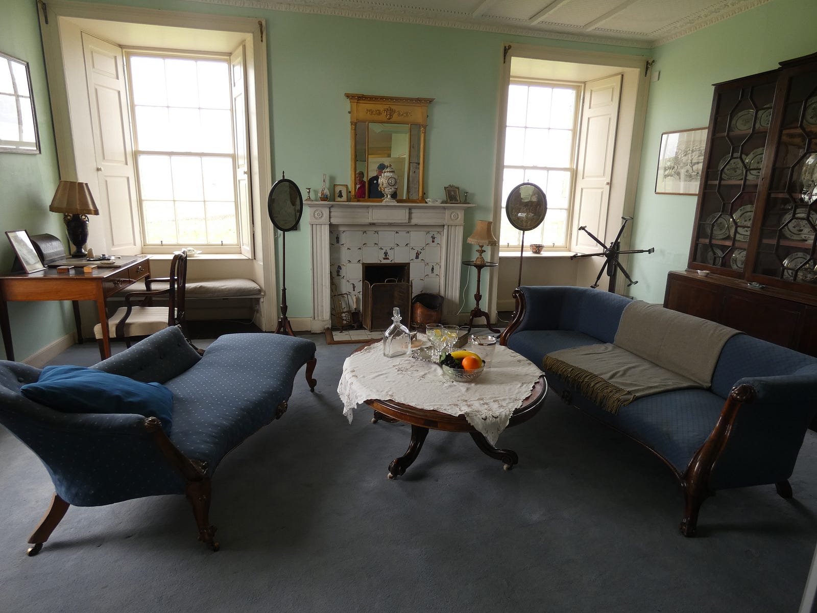
Home of the man who unearthed Skara Brae in 1850, and covering thousands of years of Orkney history, a visit to Skaill House will give a valuable insight into Orkney’s diverse and exciting past.
Overlooking the spectacular Bay of Skaill, the house was originally built in 1620 by Bishop Graham and went through some changes over the centuries. Just a short distance from the house lies the neolithic village of Skara Brae, and the southern wing of Skaill House stands on a pre-Norse burial ground.
The house was opened to the public in 1997 after careful restoration work and is very much the family home as it was in the 1950s. Captain Cook’s dinner service, Neolithic and Iron Age finds, Stanley Cursiter paintings, the Bishop’s original bed, and many other items of interest collected by the twelve Lairds of Skaill can be seen around the house.
The whole visit took about 2 hours and at the end, we decided to visit the Brough of Birsay on the northwest of the Mainland.
Brough of Birsay
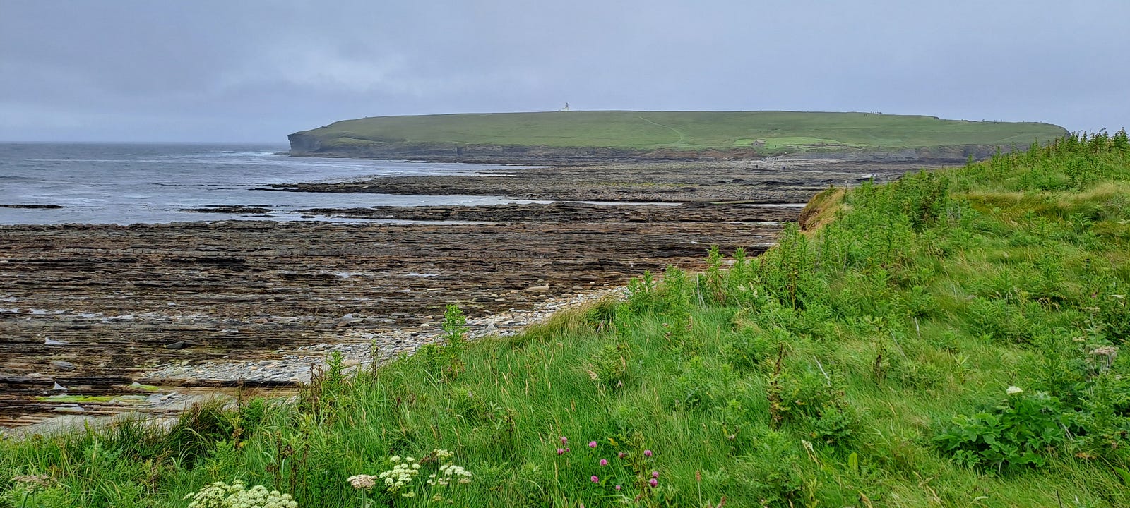
It is on a tidal island so you always must check tide tables at Skara Brae or call them on 01856 841 815. Tide Times may also be found on the Met Office website. A concrete causeway from the beach joins the Brough to the Orkney Mainland. It is approximately 150 m long and accessible during low tide (though appropriate footwear is essential as it can be slippery and uneven.) During high tide, the causeway is submerged underwater and the strong tides here make it dangerous to cross.
Before the causeway was built in the 20th century, people would have crossed over the rocks and rockpools to the Brough of Birsay. Excavation work has shown that there were Pictish inhabitants on the island from as far back as the late 6th century. Though most of the buildings seen on the Brough are from the later residents, the Vikings, traces of the earlier Pictish settlement can be found. A small well on the Brough and foundations under the later buildings are thought to be of Pictish origin, and an impressive carved Pictish symbol stone was found on the island.

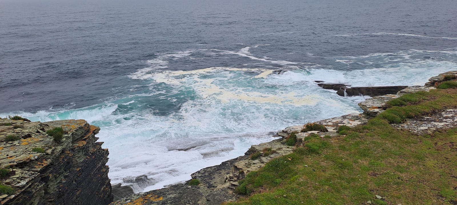
We walked up to the lighthouse to see the puffins hidden among the high rocks, surrounded by a strong sea.
It is recommended to stay away from the border of the rocks because the strong wind might lift you and cause you to fall without the possibility of survival.
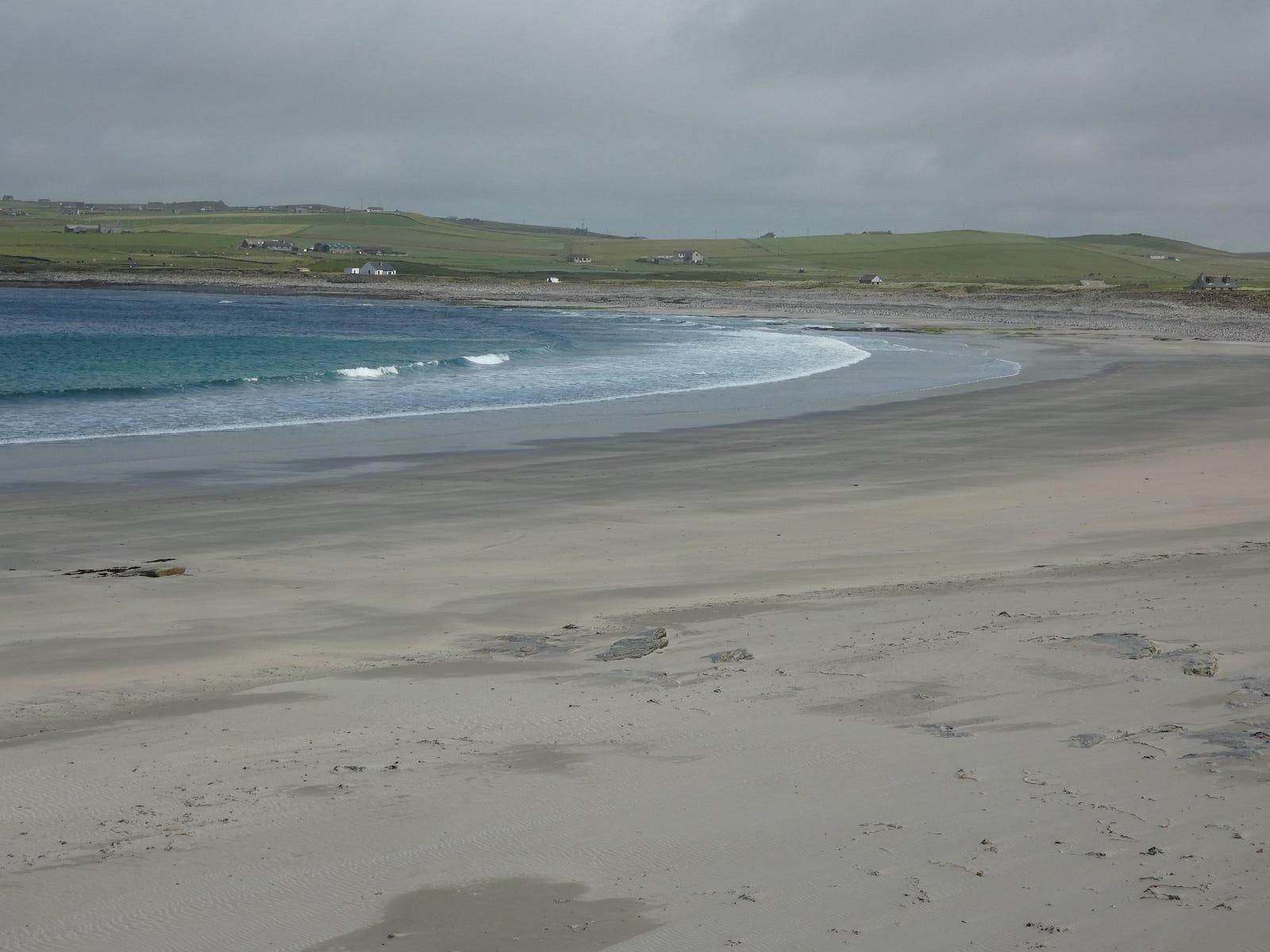
After this visit, we decided to walk along a beautiful, isolated beach in the northwest of the island before heading to the brock of Guerness.
Brock of Guerness
Archaeological excavations in the early 20th century showed that the village began between 500 BC and 200 BC.
Deep ditches and ramparts defined a large area roughly 45 m across. An entrance causeway was later added on the east side and a circular broch tower was built in the west half. A settlement of small stone houses with yards and sheds grew up around the broch tower.
The broch was abandoned and the ditches filled in sometime after AD 100. The site was then a single farmstead until around the 8th century.
Next to the visitor centre are the relocated remains of a late Iron Age or Pictish house. The last activity here took place in the 9th century, when a Viking woman was buried with her grave goods.
Deerness

One of the area’s most spectacular attractions is the Gloup, a dramatic collapsed sea cave separated from the sea by a land bridge about 80 yards wide. The cave is approximately 40 yards long and 80 feet deep. The Gloup is easily accessible from a nearby car park, where visitors will also find an interpretation centre and toilets. The area is unfenced and great care is required. It is possible to navigate and enter the Gloup in a small boat from the sea. Details of boat hire are available at the local VIC.
Further along the coast, visitors will find the Brough of Deerness, an early Christian monastery of the Celtic Church. The site is accessible by a narrow and steep cliff track. It was here that hermit monks lived simple lives in solitude with nature. The remains of their chapel can still be seen. Archaeologists held an excavation on the site in the summer of 2008, as there is so little known about the chapel.
Unfortunately, the path that brings to this archaeological site is not easy and is suspended on the rocks. Because of the strong wind and rain, we decided to change our itinerary to avoid a possible accident.
On the Orkneys, you always must take care of the weather conditions because it is on the extreme side of our planet.
At 5 pm, we finally decided to travel back to our hotel, ready for another dinner in our bedroom, because it had been impossible to find a nice table in a local restaurant.
The Orkneys are becoming popular, and the authorities should start to think about increasing the number of restaurants and hotels and regulating the number of visitors per day.
The major issue is the cruise ships that vomit every single day hundreds of tourists on the mainland, ruining the atmosphere for those people who decided to travel long distances to enjoy the silence and the wind.
Thanks for reading.
